" At Yamuna Bhujal , we specialize in the precise identification and pinpointing of borewater locations. Our expertise lies in accurately determining the most viable spots for borewells, ensuring optimal access to groundwater resources."
Learn MoreWe got best quality team and equipments for ground water survey..
Consists of German Technology Machines, Scientific and Traditional methods.

"Hello! Myself Sandip Ambike I specialize in hydrogeological surveys and geophysical investigations to identify optimal bore points and water wells. My services include site assessments, aquifer characterization, and expert guidance for sustainable, high-yield borehole drilling, ensuring reliable access to quality groundwater."
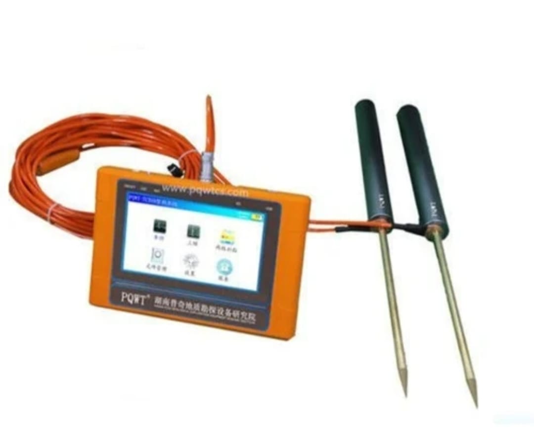
It is based on the field source of earth's electromagnetic field and differences in conductivity of different
underground geological structures, to study the variation law of electric field components at different
frequencies to study the geological structure and changes. Changes in geological structure are displayed
in real-time through multiple curves. Automatic mapping geological profile by one key operate easily, get rid of complicated computer graphics.
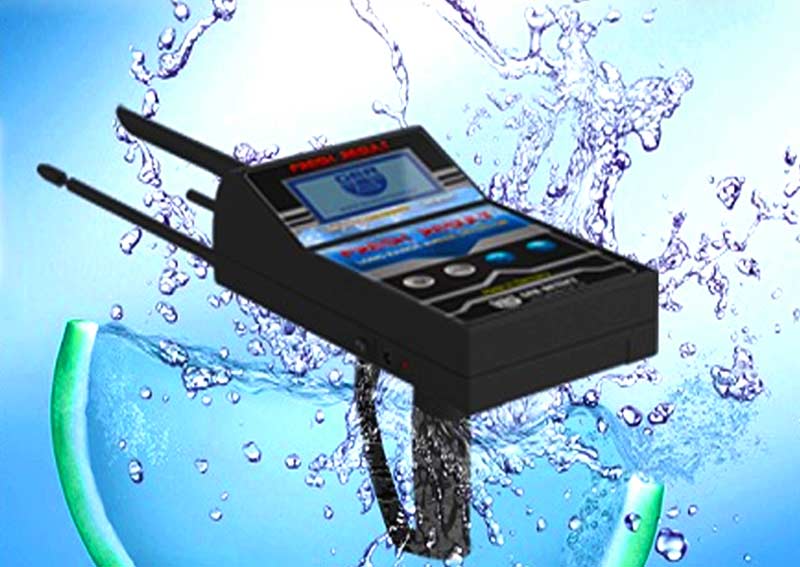
The latest device to detect underground water and artesian wells.
When the device receives a signal, it will automatically track the signal toward the target, then it turns towards the target referred to by the sender and the receiver antenna of the signal.
.jpeg)
GEO Magnetic Rod finds the width of water vain, and flowing underground vains.
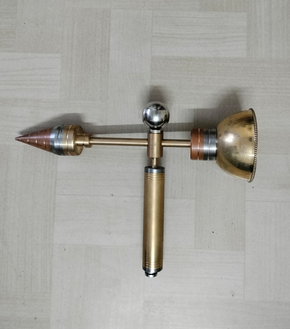
Magnetic Compass finds the strong water vain.
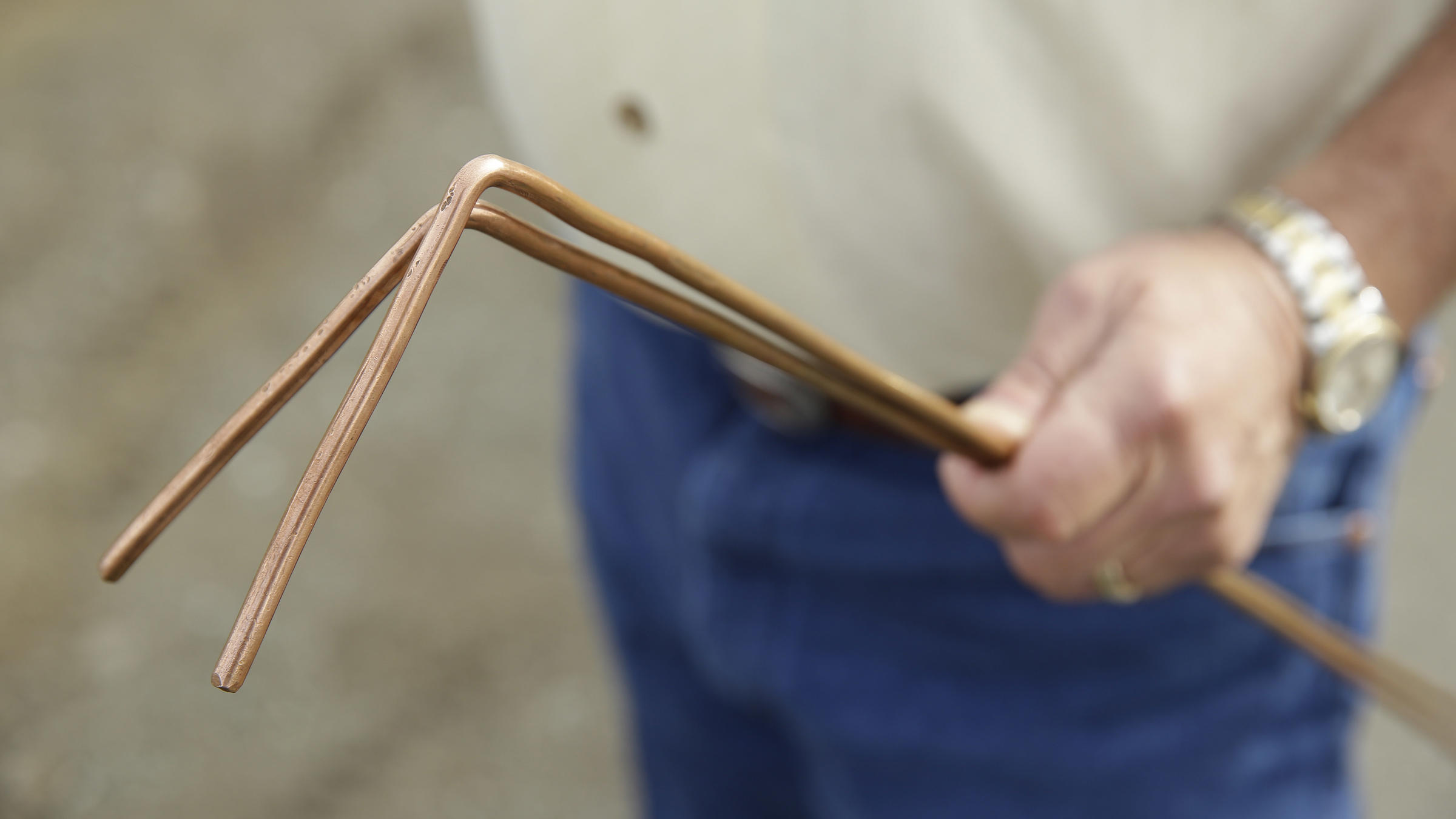
An L-rod, a metal tool bent in an L shape, is used to gauge groundwater levels. When inserted into the ground, its resistance changes at the water table, indicating the depth, aiding in estimating groundwater levels accurately.
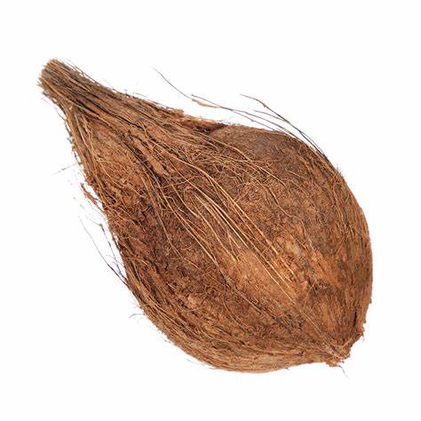
A hollowed coconut shell, floating or sinking when lowered into a well, estimates groundwater levels based on its position, a traditional method in some regions.
Here are the services we provide for identifying the best bore points:
"We specialize in pinpointing bore points accurately using a blend of traditional wisdom and modern techniques. Our services integrate time-tested methods with advanced approaches, ensuring precise identification of optimal drilling sites for water wells or bores."
Conducting detailed studies of geological formations and hydrological conditions to locate optimal borehole drilling sites.
Tailored advice on drilling depths, casing materials, and well designs based on geological data for enhanced water yield and quality.
Here are some of our recent projects you can get more projects by clicking on Read More button.
Our project focuses on a comprehensive groundwater exploration system that amalgamates traditional methods with modern technology. Through geological surveys, L-rod probing, and geophysical investigations, we locate viable bore points, ensuring reliable access to groundwater
Learn More
By combining indigenous methods like L-rod probing with advanced geophysical surveys (resistivity and seismic), we developed a robust approach. Analyzing data using GIS mapping enhanced precision in bore point identification.
Successfully identified and recommended optimal bore points in 20+ locations, aiding communities in accessing reliable water sources. Achieved an 85% success rate in borehole productivity based on our recommendations.
Learn More